|
670th Radar Squadron
 
From Wikipedia, the free encyclopedia
670th
Radar Squadron
1961-1974 Feb 1: 670th Radar Squadron (SAGE)
1950-1961 Apr 1:[1]
670th AC&W
Squadron |
Emblem of the 670th Radar Squadron
|
| Active |
1950 May 5-1976 April 1[1] |
| Country |
United States |
| Branch |
 United
States Air Force United
States Air Force |
| Type |
General Radar Surveillance
Emblem
of the 670th Radar Squadron…
|
The 670th Radar Squadron is an inactive United
States Air Force unit. It was last assigned to the 26th
Air Division, Aerospace
Defense Command, operating San
Pedro Hill Air Force Station radars while posted at Fort
MacArthur, California. It was inactivated on 1 April 1976.
The unit was a General Surveillance Radar squadron providing for
the air defense of the United States.
Lineage[edit]
Assignments
Stations
References[edit]
 This
article incorporates public
domain material from websites or documents of the Air
Force Historical Research Agency. This
article incorporates public
domain material from websites or documents of the Air
Force Historical Research Agency.
- Mueller, Robert, Air Force Bases, Vol. I, Active Air
Force Bases Within the United States of America on 17 September
1982, [1]
Office of Air Force History, Washington DC (1989) ISBN
0-912799-53-6.
- Winkler, David F. & Webster, Julie L., Searching the
Skies, The Legacy of the United States Cold War Defense Radar
Program, [2]
US Army Construction Engineering Research Laboratories, Champaign,
IL (1997).
|
|
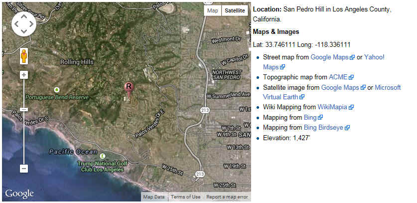
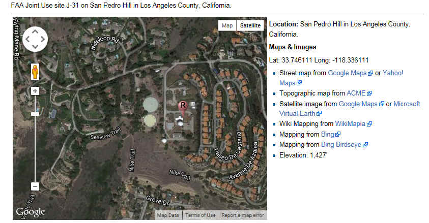
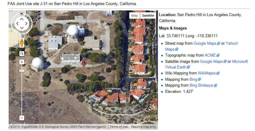
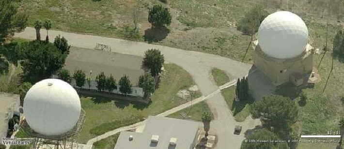
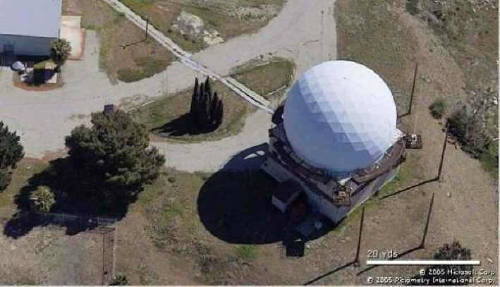
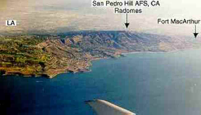
San Pedro Hill
Air Force Station by John Stanton
From FortWiki http://www.fortwiki.com/File:San_Pedro_Hill_AFS_-_05.jpg
|
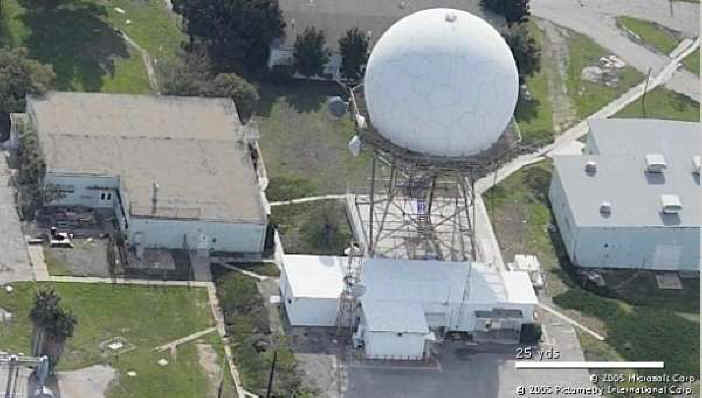
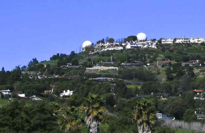
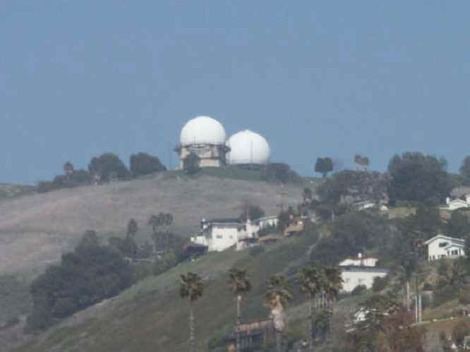
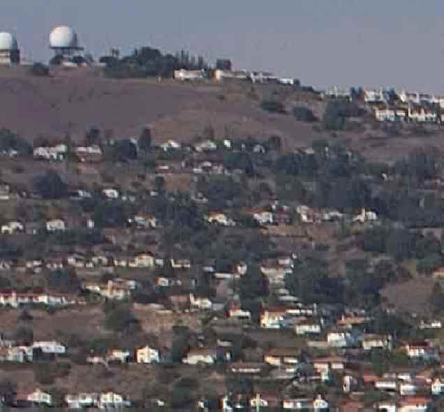
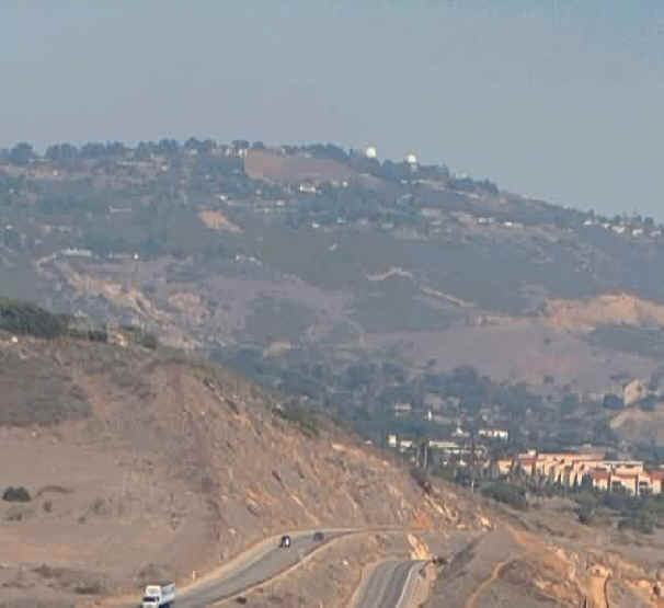
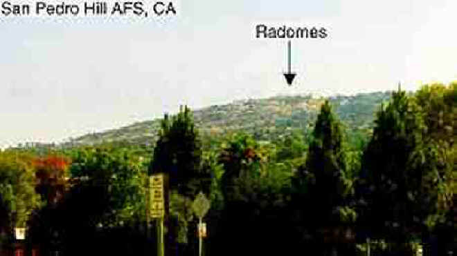
San Pedro Hill Air Force Station (1961-1976) - A Cold
War Air Force Radar Station first established in 1961 near
San Pedro, Los Angeles County, California. Named San Pedro
Hill Air Force Station after the location. Initially assigned
a Permanent ID of RP-39, later a Sage ID of Z-39 and a JSS ID
of J-31. Became an FAA site in 1976 with USAF Height finders
manned by a USAF detachment.
|
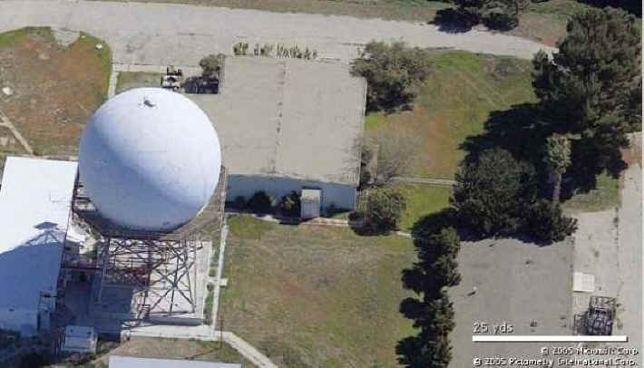
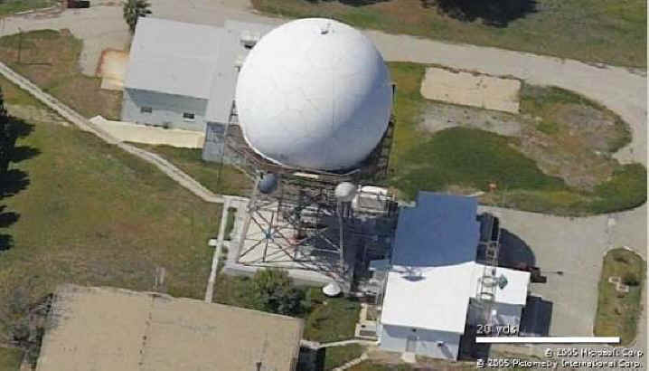
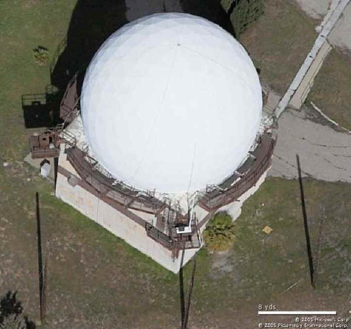
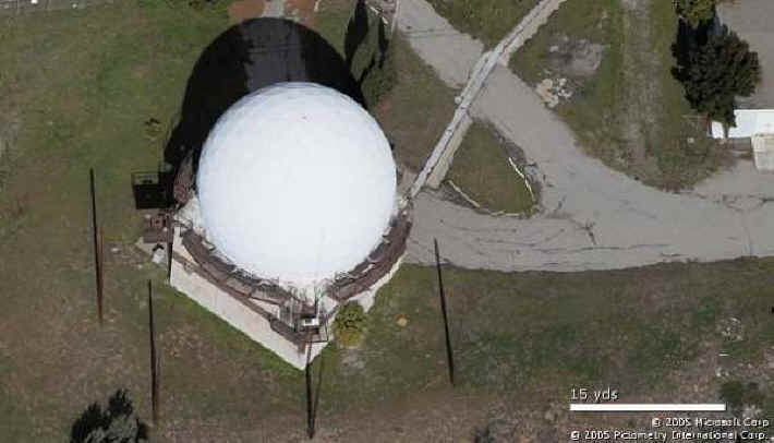
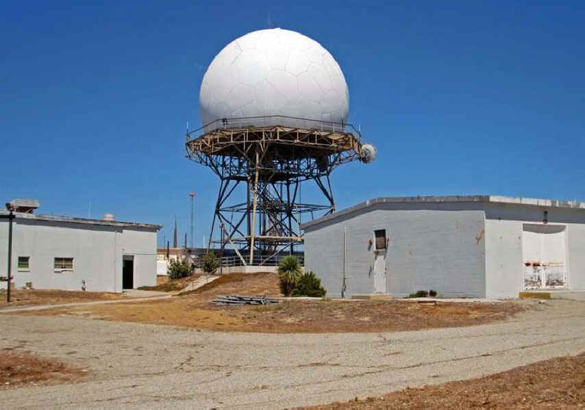
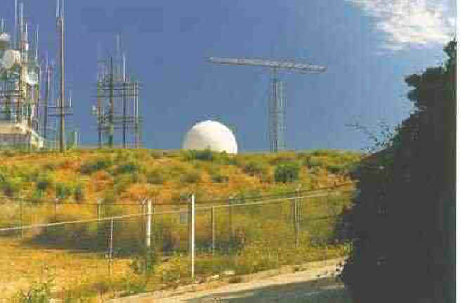
|
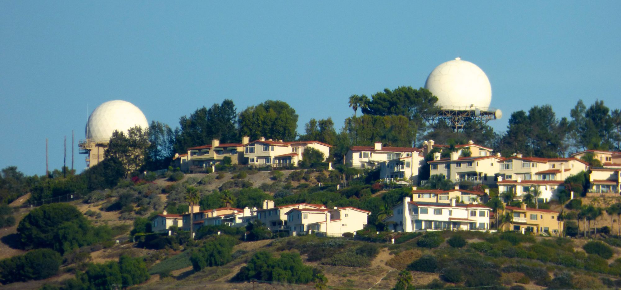
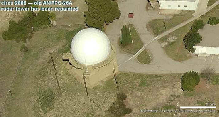
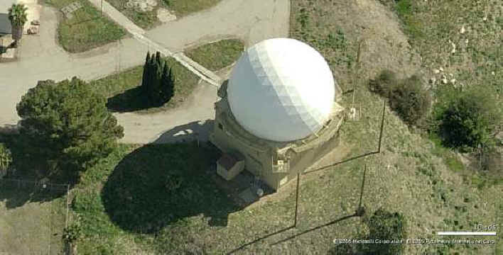
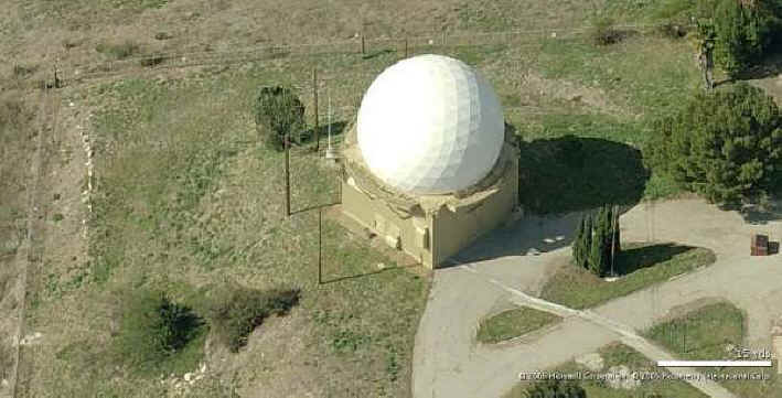
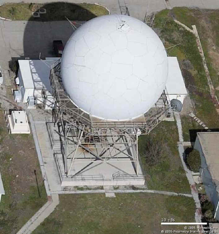
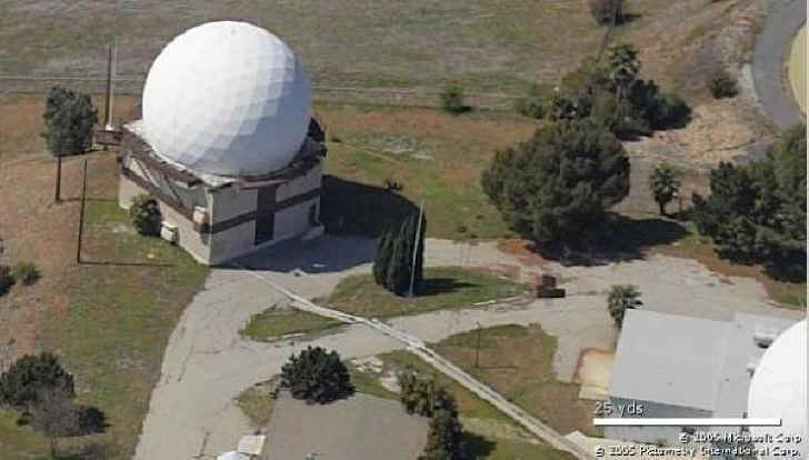
San Pedro Hill Radar Site, FPS-26 Tower on
the Left, ARSR-1E Tower on the Right, Photo by
John Stanton
|
History
of San Pedro Hill Air Force Station
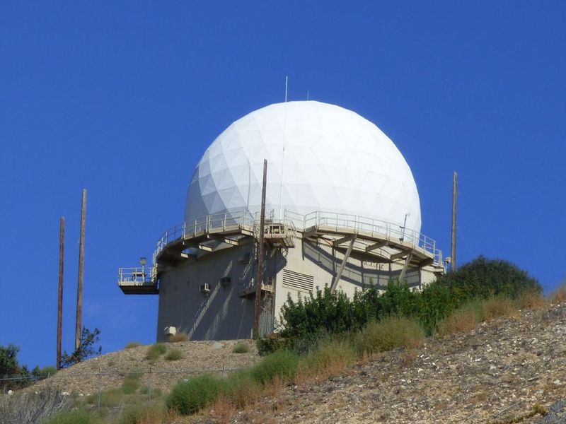
Photo by John Stanton
San Pedro Hill Radar Site FPS-26 Tower

San Pedro Hill Radar Site
Photo by John Stanton
Overview 2008
Established in 1960 as a joint use (FAA/USAF/Army) site and
became operational in 1961 as San Pedro Hill Air Force Station
manned by the 670th AC&W Squadron. Initial equipment
included an FAA ARSR-1C search radar, a USAF FPS-6 height
finder and a USAF FPS-26 height finder.
The 670th AC&W Squadron moved from San Clemente Island
to new facilities on San Pedro Hill to begin SAGE operations.
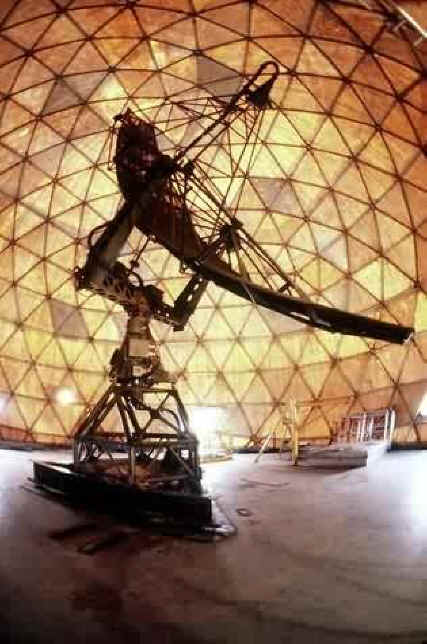
The SAGE system used the FST-2 coordinate data transmitter to
digitized the radar returns and transmitted them to the SAGE
direction center. Under the SAGE system interceptor aircraft
were directed to their targets by the direction center
computers and controllers, greatly reducing the need for local
controllers and equipment at every radar station.
The FST-2 was a very large digital system using vacuum tube
technology. Over 6900 vacuum tubes were used in each FST-2
requiring 21 air conditioned cabinets, 40 tons of
airconditioning, 43.5 kva of prime power and usually a large
new addition to the operations building. The FST-2B
modification added two more cabinets but with newer solid
state (transistor) technology to process coded responses from
aircraft transponders. The T-2 was replaced in the 1970s by
the FYQ-47/Common digitizer.
The site began operation as a SAGE site in 1961 initially
feeding the Norton
SAGE Direction Center DC-17. With the closure of DC-17 on
25 Jun 1966 control was transferred to Luke
SAGE Direction Center DC-21 at Phoenix, Arizona.
San Pedro Hill AFS and the 670th were deactivated 1 Apr
1976 and the site was turned over to the FAA. The height
finder radars were then operated by a USAF detachment
headquartered at Luke AFB, AZ. Became joint use site JSS J-31.
Replaced by site J-31A (Navy ARSR-4) on San Clement Island in
the JSS system. Now data tied into the JSS system.
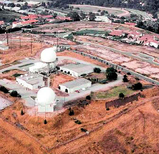
San Pedro Hill AFS Major Equipment List
| Search Radar |
HF Radar |
Data Systems |
|
|
- FPS-6A
- FPS-90
- FPS-26
- FPS-116
|
- FST-2/A/B
- FYQ-47/Common Digitizer
|
|
Unit Designations
- 670th Aircraft Control & Warning
(AC&W) Sqdn (1951-1961)
- 670th Radar Squadron (SAGE) (1961-1974)
- 670th Radar Squadron (1974-1976)
|
|
670th Assignments
- 1 Jan 1951 Assigned as 670th AC&W
Squadron to Camp
Cooke, CA
- 1 Jan 1951 - 6 Feb 1952 Assigned to 544th
AC&W Group
- 1 Feb 1952 Moved to San Clemente Island, CA
- 6 Feb 1952 - 1 Oct 1959 Assigned to 27th AD
- 1 Oct 1959 - 1 Apr 1966 Assigned to Los Angeles
ADS
- Apr 1961 Moved to Fort MacArthur AI (San Pedro
Hill AFS)
- 1 Apr 1961 Redesignated 670th Radar Squadron
(SAGE)
- 1 Apr 1966 - 19 Nov 1969 Assigned to 27th AD
- 19 Nov 1969 - 1 Apr 1976 Assigned to 26th AD
- 1 Feb 1974 Redesignated 670th Radar Squadron
- 1 Apr 1976 Deactivated
|
Current
Status
See Also:
Sources:
- Cornett, Lloyd H. & Johnson, Mildred W., A
Handbook of Aerospace Defense Organization (1946-1980),
Office of History ADC, Peterson AFB, Colorado, 31 Dec
1980, 179 pages, page 159
- Winkler, David F., Searching the skies: the legacy of
the United States Cold War defense radar program, USAF
Hq Air Combat Command, 1997, 192 pages, page 103
Links:
Visited: Area 5 Oct 2014
|
|
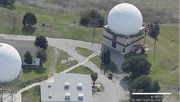
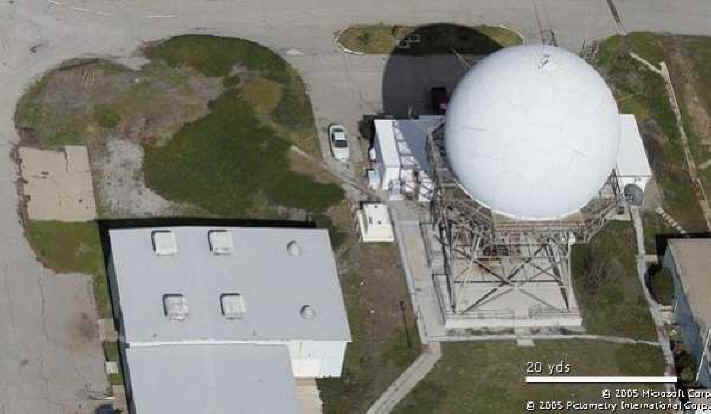
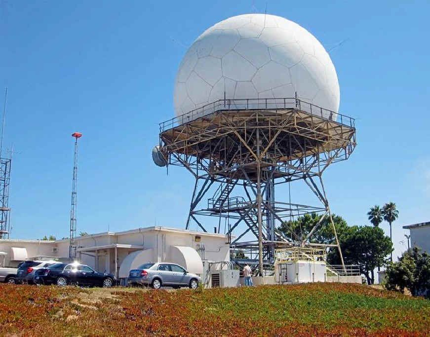
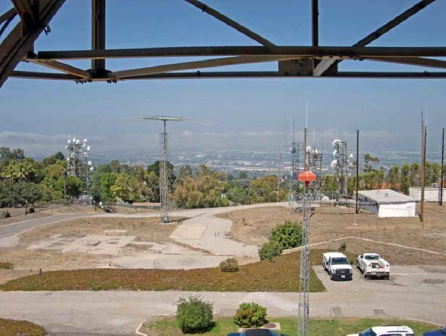
670th Radar Squadron San Pedro Hill, CA from www.radomes.org
Looking North
Looking East
Looking South
Looking West
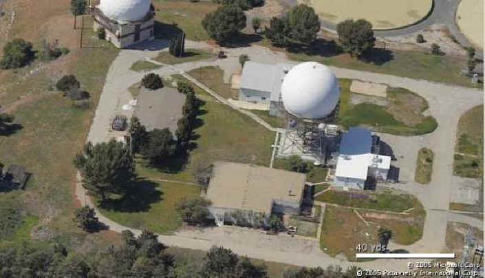
Site Looking West
Site Looking South
Looking South
Ops Looking West
ARSR-1 Looking North
ARSR-1 Looking North
ARSR-1 Looking East
ARSR-1 Looking West
FPS-26
FPS-26 Looking North
FPS-26 Looking East
FPS-26 Looking West
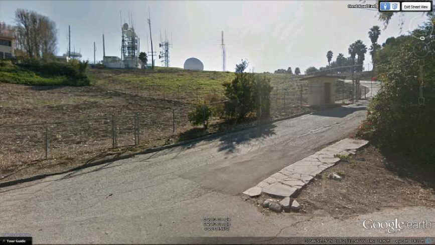
A view of the site entrance off Crest Road on San Pedro Hill.
Source: http://boondogsworld.phanfare.com/2261723_4723951#imageID=171519201
The concrete pad for the long-gone AN/FPS-27 search radar tower can be
seen.
Source: http://boondogsworld.phanfare.com/2261723_4723951#imageID=171519201
Source: http://boondogsworld.phanfare.com/2261723_4723951#imageID=171519201
source: http://www.flickr.com/photos/spacemanbob/2275551422/
© Copyright - All Rights Reserved - Displayed here for historical /
non-commercial purposes only.
2004 photos contributed by Tim
Tyler
Photos taken from approx. 2 miles away
2004 photos from the "California
Coastline" web site
From the "California
Coastline" web site

Photos taken July 1998
AN/FPS-116 1988
|
| |
| |
|
Ground Equipment
Facility J-31
From Wikipedia, the free encyclopedia
Ground Equipment Facility J-31 (San Pedro Hill Air Force
Station during the Cold
War) is a Joint
Surveillance System radar site of the Western
Air Defense Sector (WADS) and the Federal
Aviation Administration's air
traffic control radar network [1]
for the Los
Angeles Air Route Traffic Control Center. The facility's Air
Route Surveillance Radar Model
1E with an ATCBI-6 beacon
interrogator system are operated by the FAA[3]
and provide sector data to North
American Aerospace Defense Command. The site provided Semi-Automatic
Ground Environment data to the 1959-66 Norton
AFB Direction Center for the USAF Los
Angeles Air Defense Sector. The site also provided Project
Nike data to the 1960-74 Fort
MacArthur Direction Center ~3 mi (4.8 km) away for the
smaller US Army Los
Angeles Defense Area[4]—as
well as gap-filler[specify]
radar coverage for the 1963-74 Integrated
Fire Control area of Malibu Nike battery LA-78 on San
Vicente Mountain.[5]
History[edit]
The "ADC/FAA joint-use facility" began operations in 1961
with an FAA ARSR-1C
radar.[1]
After the April 1, 1961, move of the 670th
Radar Squadron (SAGE)--formerly the 670th AC&W
Squadron—from San
Clemente Island Air Force Station, the Los
Angeles Air Defense Sector was activated June 1.[6]
The squadron was assigned to the "Fort
MacArthur AI"[6]
(Army Installation) and operated the San Pedro Hill radars which
included a General
Electric AN/FPS-6B Radar and an Avco
AN/FPS-26 Radar for height finding. In 1964, the station's Westinghouse
AN/FPS-27 Radar was installed (removed 1969) and the AN/FPS-6B was
modified to an AN/FPS-90.[citation
needed] In April 1976 the squadron was
redesignated Detachment 1 of Luke
AFB's 26th
Air Defense Squadron[6]
(the AN/FPS-26A was removed in this time frame).[citation
needed]
The radar station with 18 military & 5 civilians was planned
for transfer after the 1978 Base
Realignment and Closure Commission.[7]
After the station transferred to the FAA when Aerospace
Defense Command was inactivated, the Air Force continued to
operate the AN/FPS-90 height-finder by then modified to an AN/FPS-116
(removed c. 1988).[8]
In the late 1990s, the Air Force terminated the data-tie at San Pedro
Hill and established a data-tie with the new Navy-installed ARSR-4
radar at San
Clemente Island's Mount
Thirst. The Raytheon
ARSR-1E Radar at San Pedro Hill was in use by November 2010.[3]
References[edit]
- ^ Jump
up to: a b
c
Winkler,
David F; Webster, Julie L (June 1997). Searching
the Skies: The Legacy of the United States Cold War Defense
Radar Program (Report). U.S. Army Construction Engineering
Research Laboratories.
Retrieved 2012-03-26.
- ^ Jump
up to: a b
c
San
Pedro Hill Air Force Radar Station (Map). wikimapia.
Coordinates: 33°44'46"N 118°20'10"W
- ^ Jump
up to: a b
Pace,
Joe (November 2010). "The
President Paces Himself" (K6PV newsletter). Palos
Verdes Amateur Radio Club. p. 2.
Retrieved 2012-05-08.
an
Air Route Surveillance Radar Type 1E…by Raytheon…in
continuous service by the FAA since it’s installation in 1959.
[sic]
I…visit[ed] with one of the FAA engineers that has
taken care of its operation for more than 30 years… This is a
primary radar facility for high-altitude (en-route) air traffic
control, with a range of 200 miles. Coupled…is the beacon
interrogator system (ATCBI-6)… The San Pedro Hill facility is
one of 22 in the FAA system using ARSR-1E
- Jump
up ^ Kenyon,
Ed (March 17, 1963). "It's
a Different World Inside Radar Facility" (NewspaperArchive.com
image). Independent Press Telegraph. p. 15.
The
Army's missile
master control center at Fort MacArthur uses the data for
its Nike missile defense network.
- Jump
up ^ Berhow,
Mark A; Gustafson, David (2011-electronic edition) [1st
published 2002]. Fort
MacArthur (Report). Fort MacArthur Military Press. p. 55.
Retrieved 2012-05-25.
- ^ Jump
up to: a b
c
compiled by Johnson,
Mildred W. (31 December 1980) [February 1973: Cornett, Lloyd H.
Jr]. A
Handbook of Aerospace Defense Organization 1946 - 1980. Peterson
Air Force Base: Office of History, Aerospace Defense Center.
p. 33 ("1961…1 April - Los Angeles ADS became
operational.").
Retrieved 2012-03-26.
669th
Radar Sq (SAGE): assigned 1 Jan 51 at Ft. MacArthur,
CA,…moved to Santa
Rosa Island, CA 11 Feb 52;…moved to Lompoc
AFS, CA 1 Apr 64 … 670th Radar Sq (SAGE):…redesignated
to 670th Radar Sq (SAGE) (from AC&W Sq) 1 Apr 61; moved to
Ft. MacArthur AI, CA in Apr 61
- Jump
up ^ "Western
bases" (Google News Archive). Lodi
News-Sentinel. April 27, 1978.
Retrieved 2012-03-26.
Mt.
Laguna -- Air Force station transferred to FAA affecting 133
military and 30 civilian.
- Jump
up ^ [specify] This
article incorporates public
domain material from websites or documents of the Air
Force Historical Research Agency.
Current Status
|
|


